|
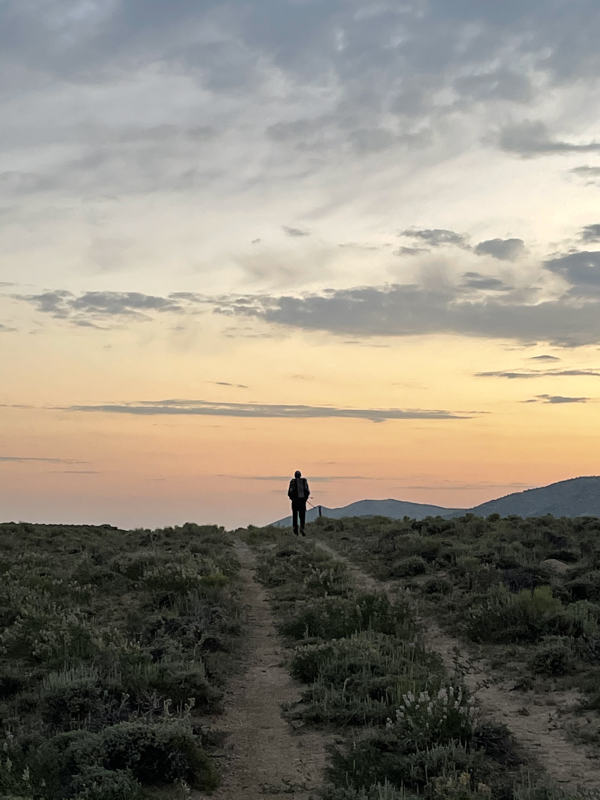
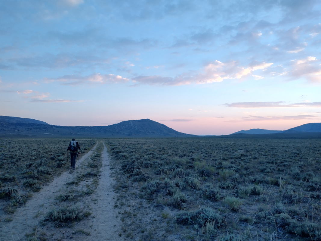
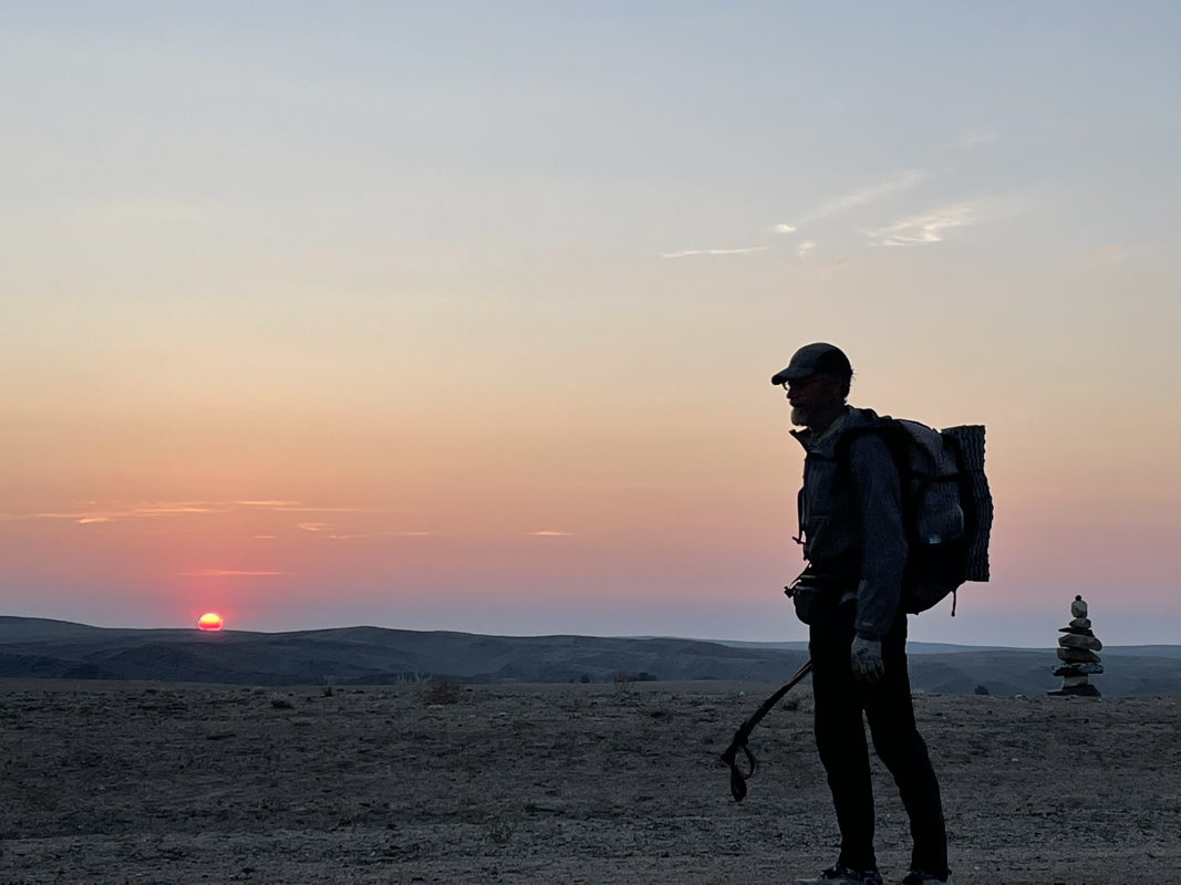
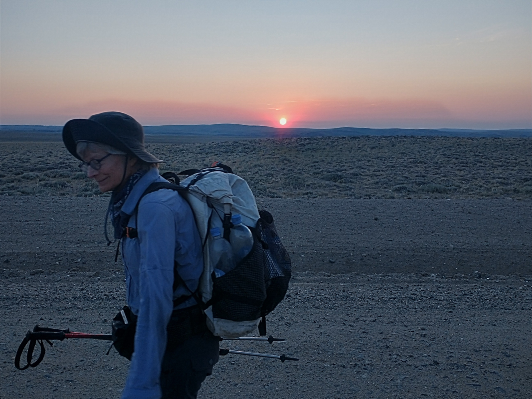
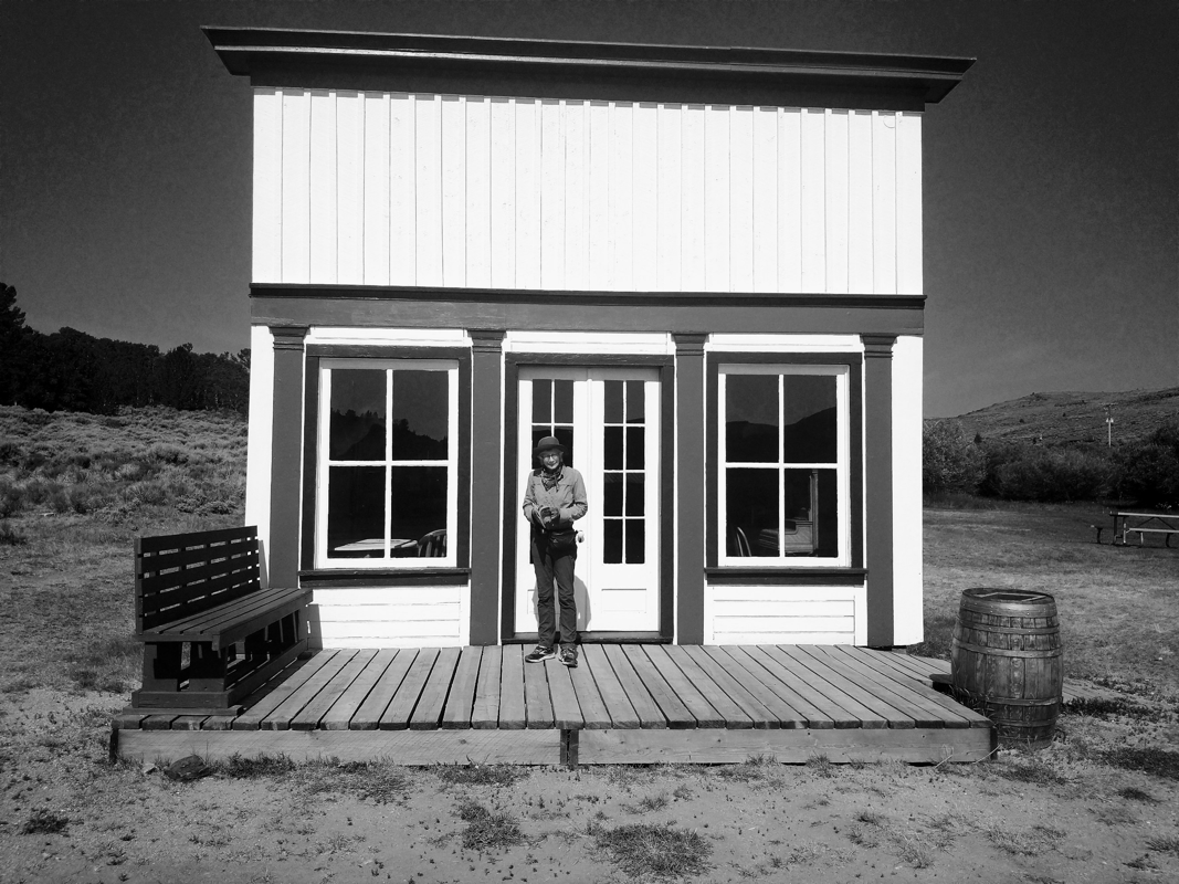
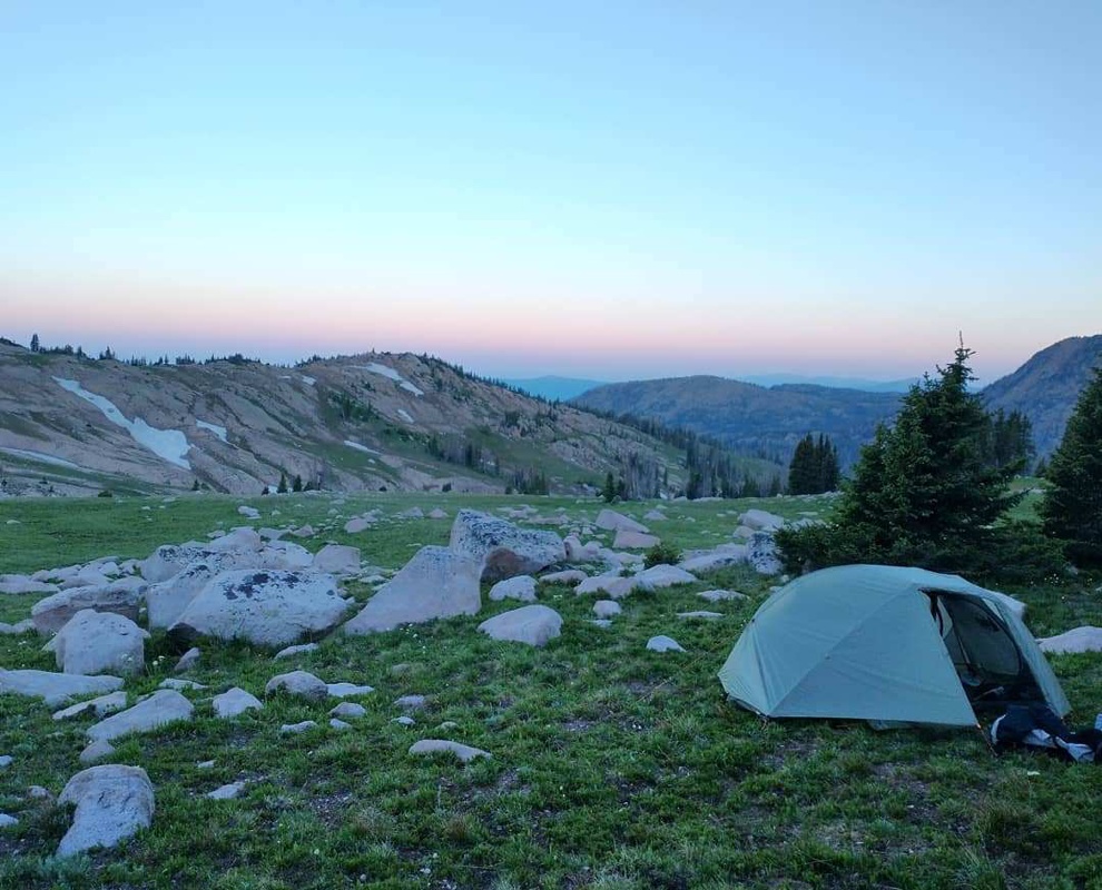
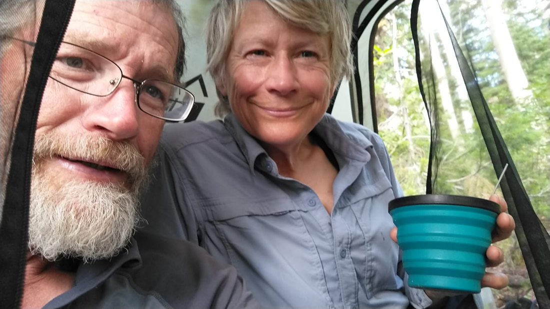
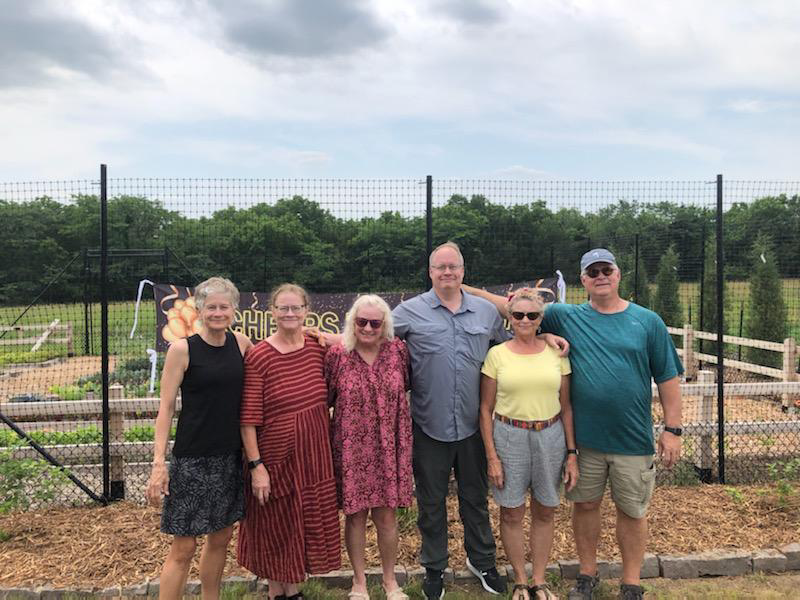
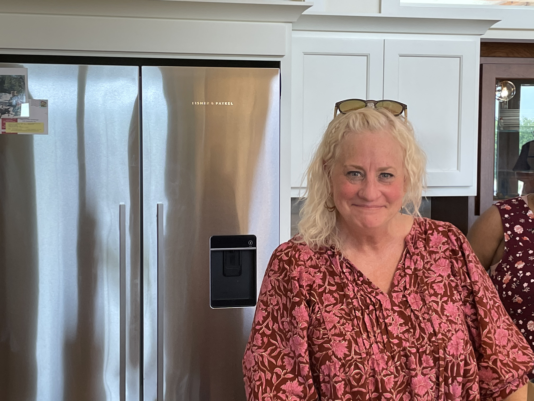
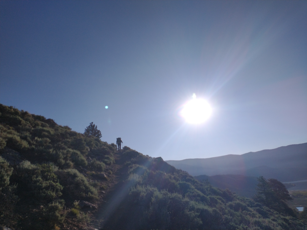
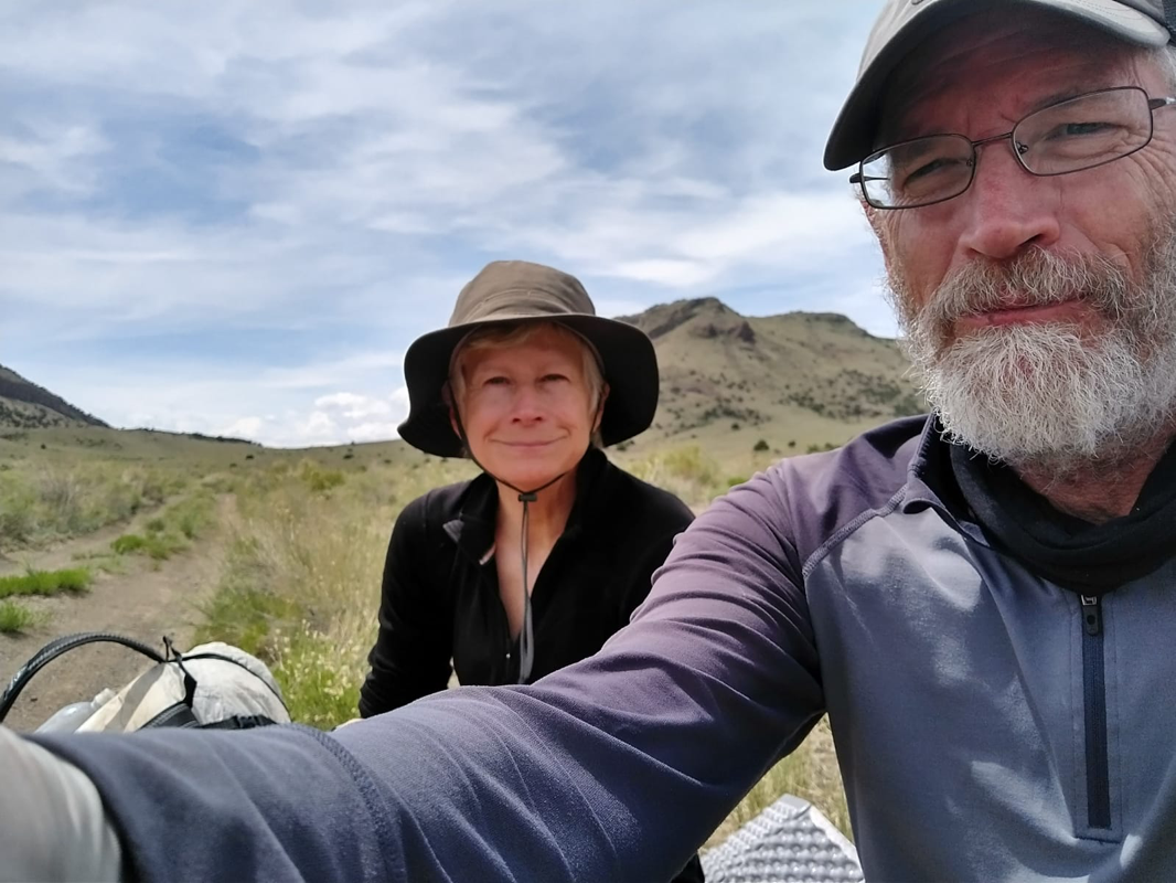
We finished the Great Divide Basin!! Five days of hiking through flat, hot, and repetitive landscape. We made fast miles, hiking an average of 26 miles a day. Others hiked between 35-40 miles a day. Young whippersnappers. Many of the water supplies were poopy cow ponds (I may never get the smell of cow poop out of my nose), others were cold springs. We timed our campsites with small oases—a river or large pond. And know what? We had a lot of fun and enjoyed ourselves. Heat be damned. One morning we woke up at 2:30 am to beat the heat. Sunrise is the best time of day, for sure. We finished this section more exhausted than usual due to the high miles and long days. Landed in one of our favorite trail towns, Lander, Wyoming. And as promised, I’ll describe our most excellent nearo, followed by a zero day. NEARO FOLLOWED BY A ZERO IN LANDER! Monday, July 19. 2:30 am. Wake up, excited to be hiking into Lander! Feeling tired due to lack of sleep, heat, and long miles. 9:30. Nice surprise, we hike into South Pass City, a restored ghost town. Since the CDT goes right through the town, it’s free for CDT hikers. Plus they sell ice cream and root beer! We call for a shuttle to pick us up and enjoy being tourists. Noon. Have our shuttle driver and trail angel, Pulp Fiction, drop us off at The Lander Bake Shop where we drink lots of good coffee and eat baked goods. Yum. Marvel at how my bowels seem to know when we’re in town. 1:30. Walk to NOLS to buy dehydrated food. Hang out with fellow thruhiker, Costanza, while doing laundry. 3:00. Go to grocery store to buy some late lunch: fried chicken, potato salad, Hawaiian rolls, and mango smoothie. 4:00. Go to the Aquatic Center to shower. 5:00. Set up our tent in the city park. Live music. Pulp Fiction and Costanza supply dinner for the hungry hiker masses. Spend the evening talking and eating with others. 8:00. Go to tent and sleep like babies. Tuesday, July 20. 6 am. Sleep late, until 6 am!! Go eat breakfast at the Ox Bow. Marvel at the low cost of dining in Wyoming compared with Colorado. 8:00 Go to nearby coffee shop. Drink lots of good coffee. Stare at phones, make lists of things to do. Talk about an alternate route to avoid Idaho/Montana forest fires. 9:50 Go back to Lander Bake Shop to buy scones for tomorrow’s breakfast. 10:00 Go to the public library!! Charge batteries (literal and metaphorical), write letters and blog entry. 1:30 Go back to Lander Bake Shop a third time to buy a lemon bar and a chocolate/peanut butter bar. Eat these for lunch, along with salad-in-a-bag purchased yesterday. 2:00 Head to grocery store to buy resupply. I love to grocery shop!! I spend hours creating resupply lists, looking for that right combination of low weight, high calorie, and good tasting food. 3:00 Arrive back at tent, now soaked by the park sprinklers. Assess damage. 5:00 Eat dinner at the Chinese restaurant. Lots of veggies. 6:30 Repackage food and pack our backpacks. Read a book or watch something downloaded on my phone. 8:00 Set our alarm for early morning and sleep... onward through the Wind River Range!!
0 Comments
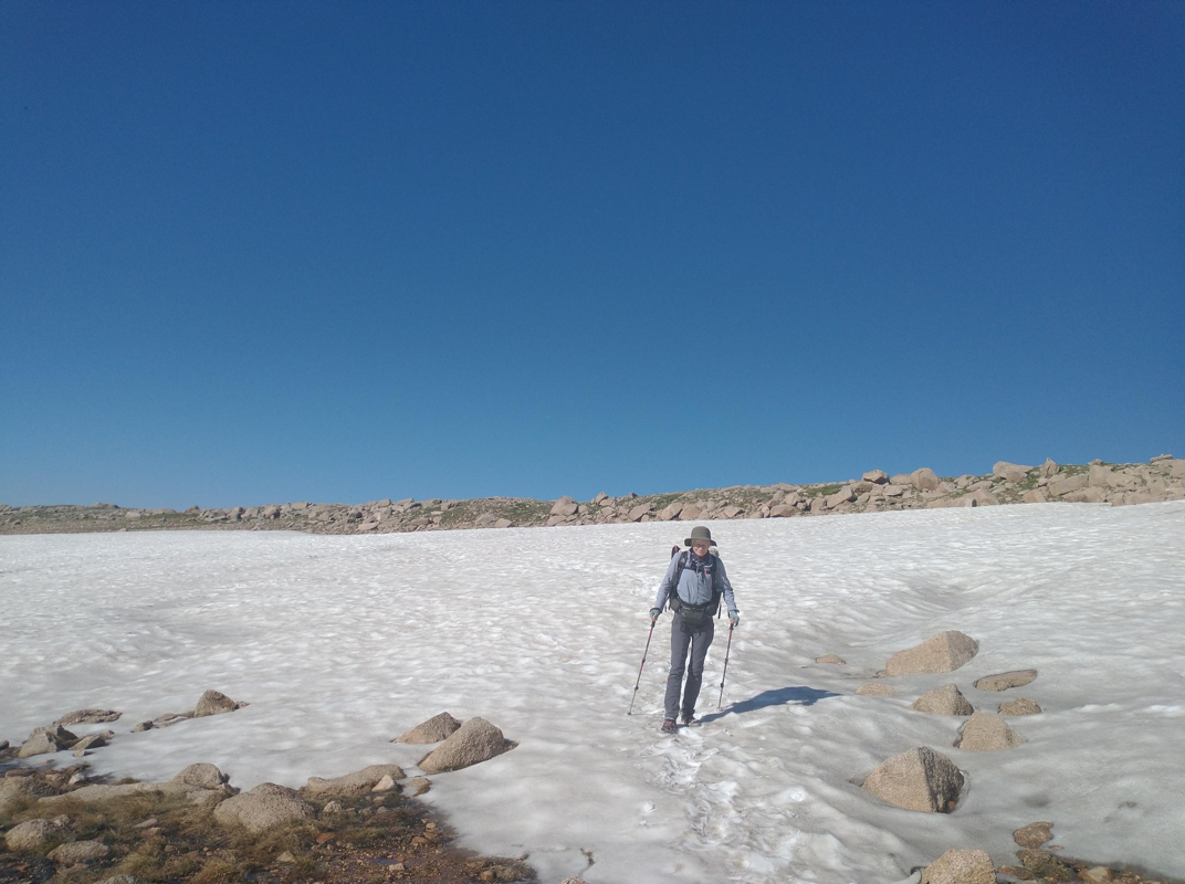
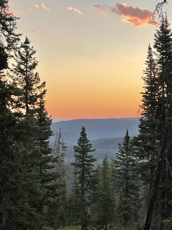
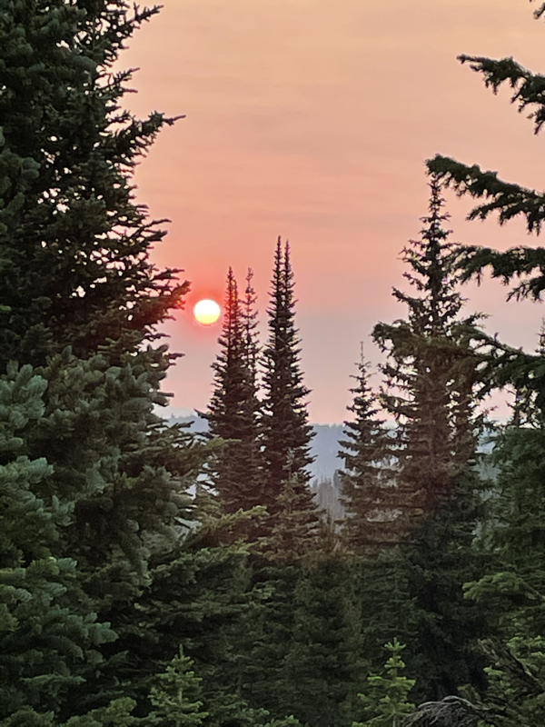
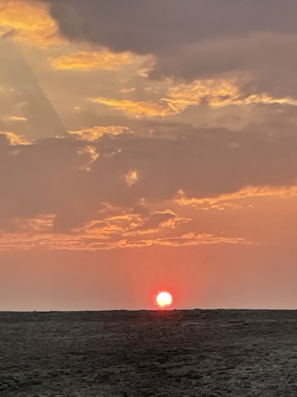
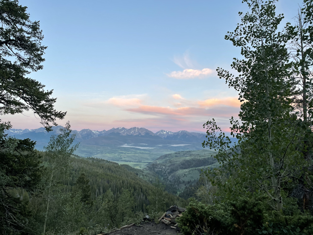
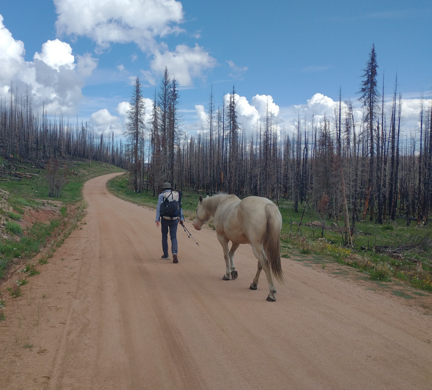
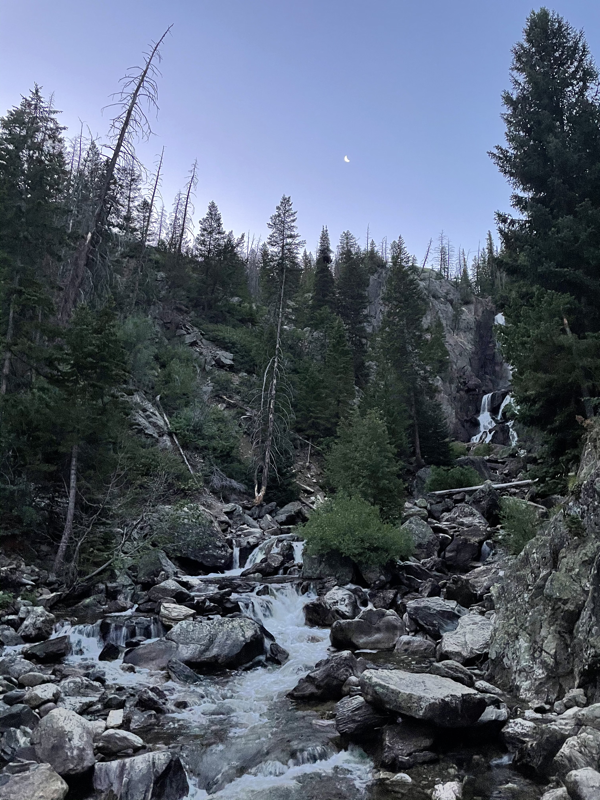
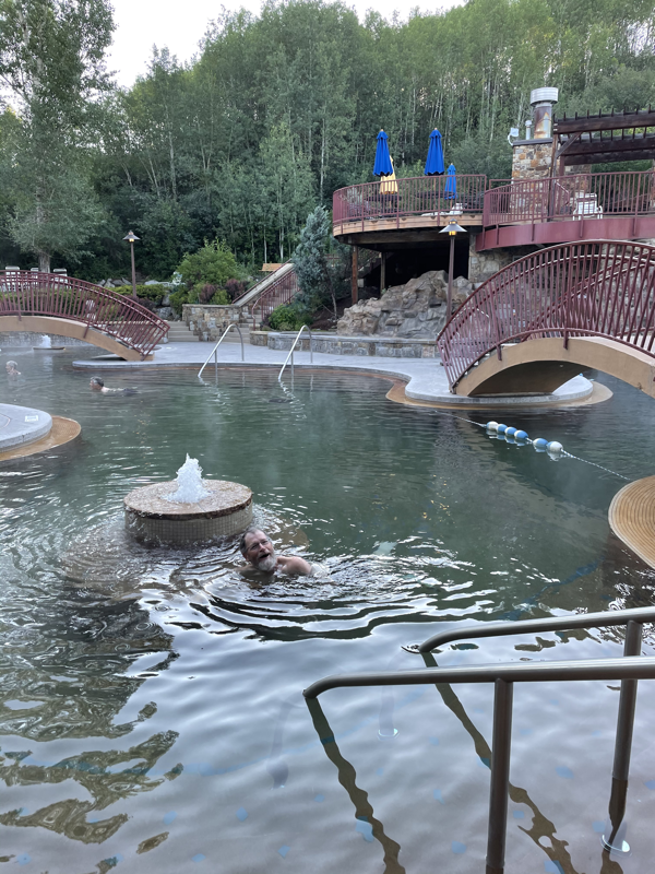
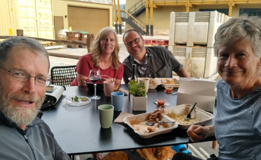
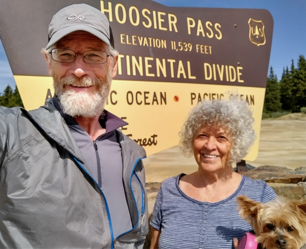
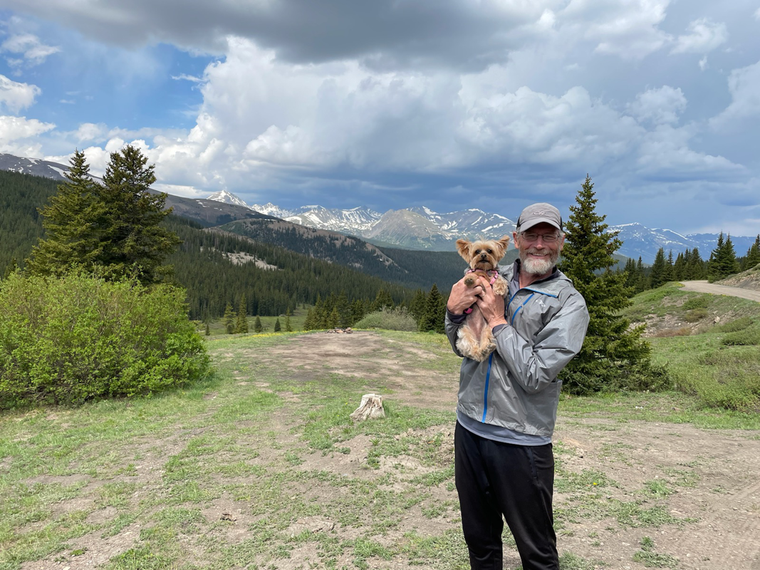
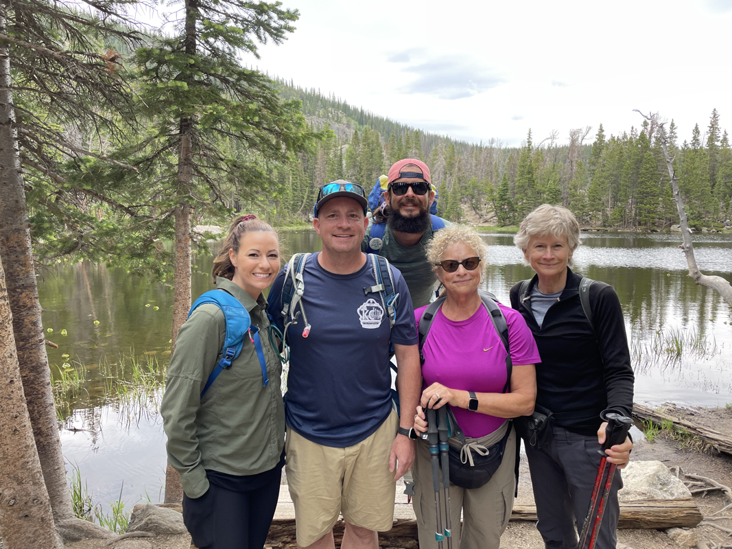
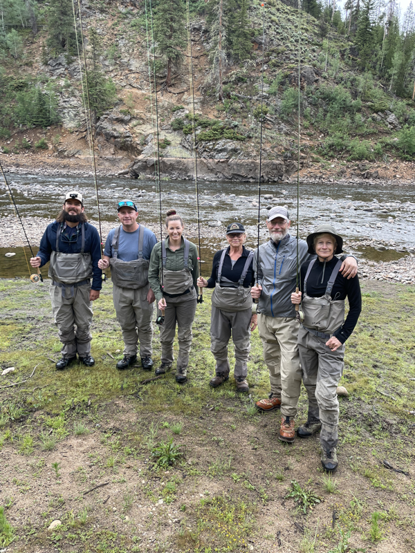
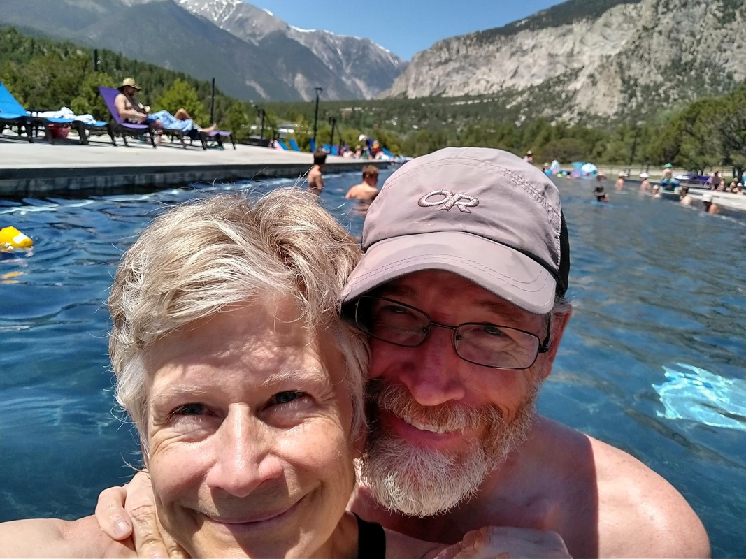
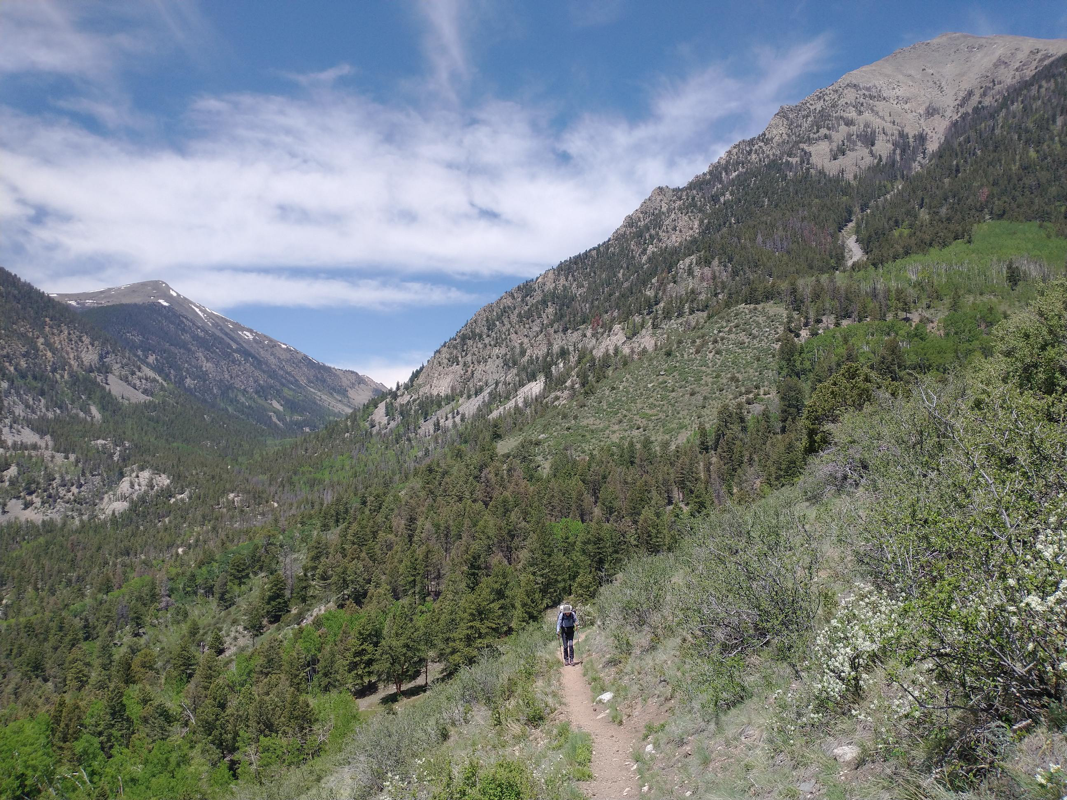
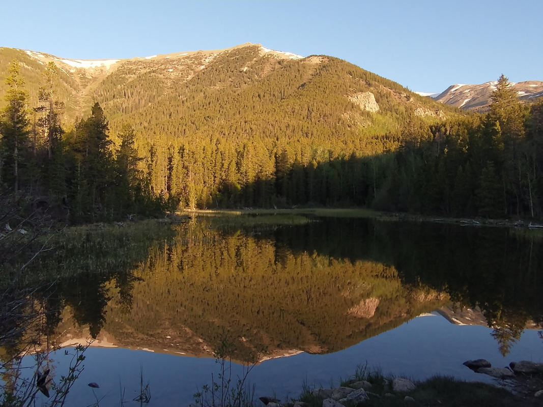
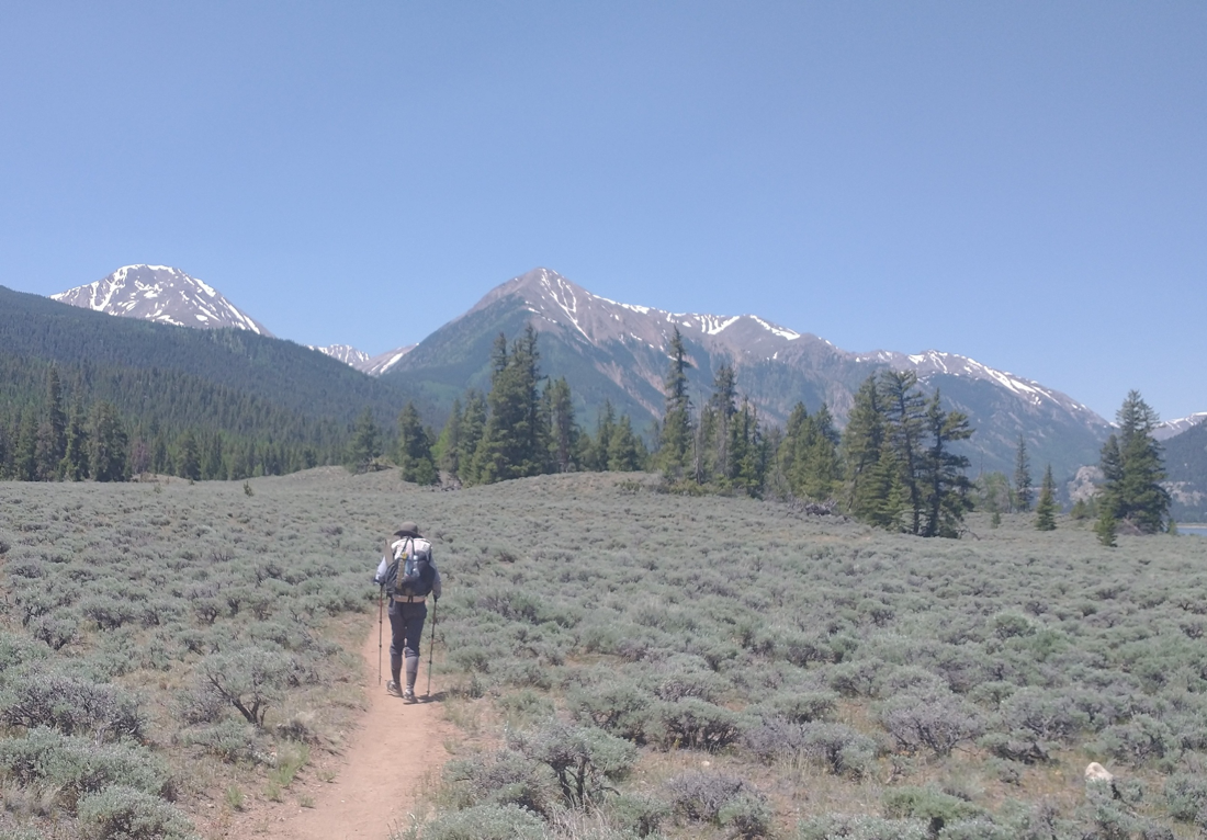
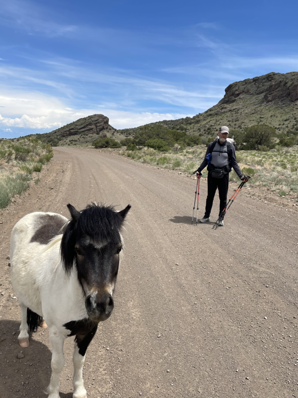
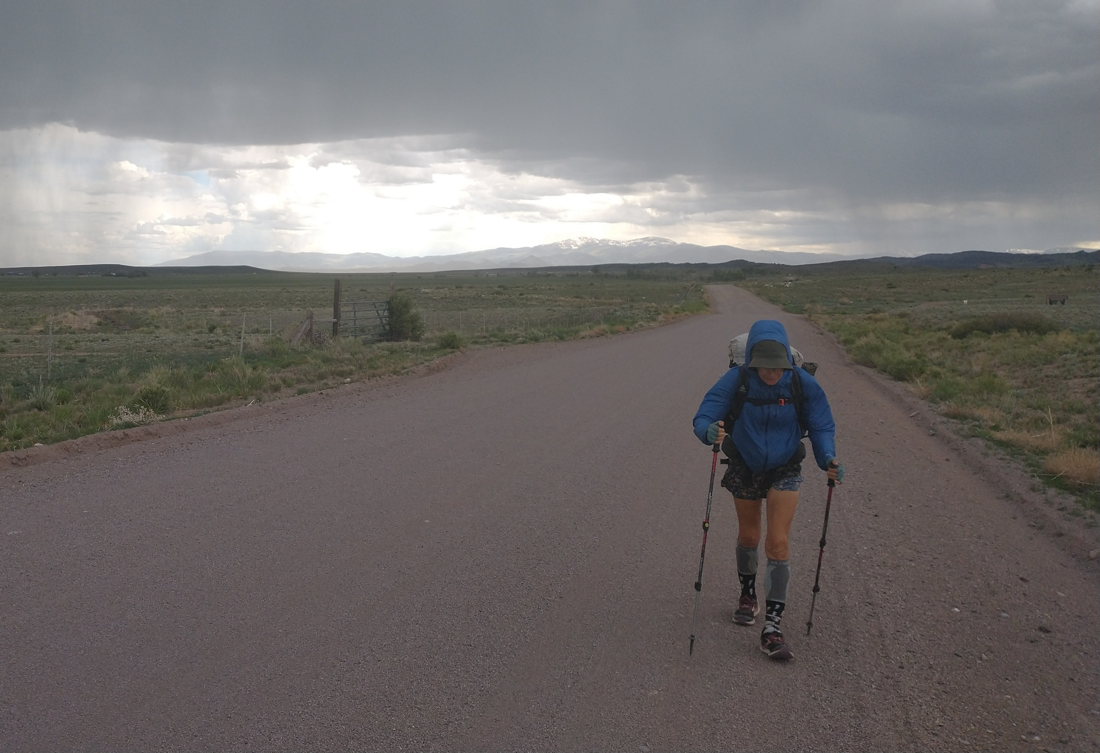
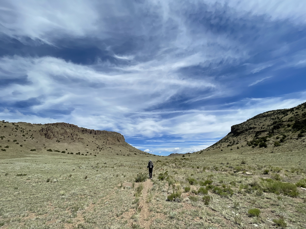
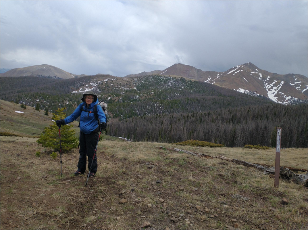
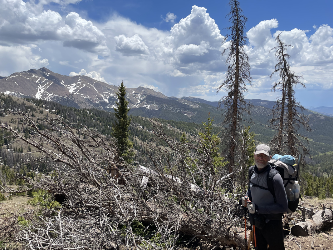
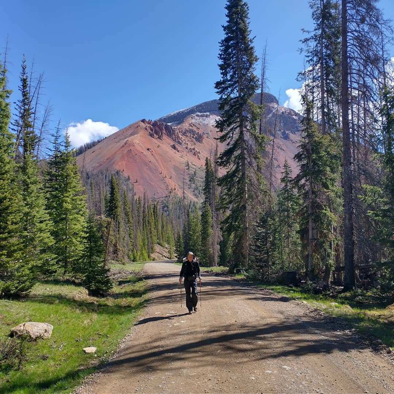
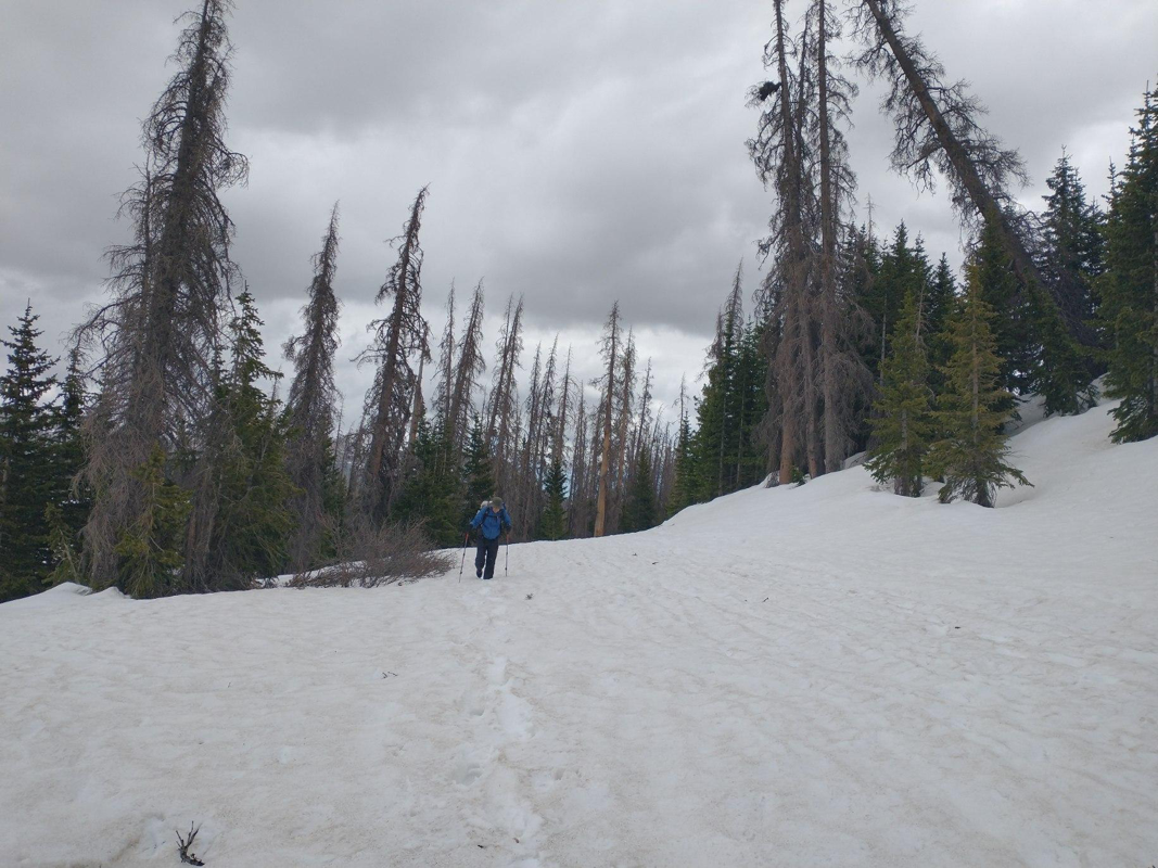
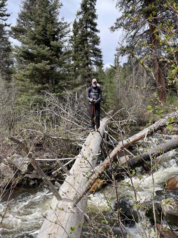
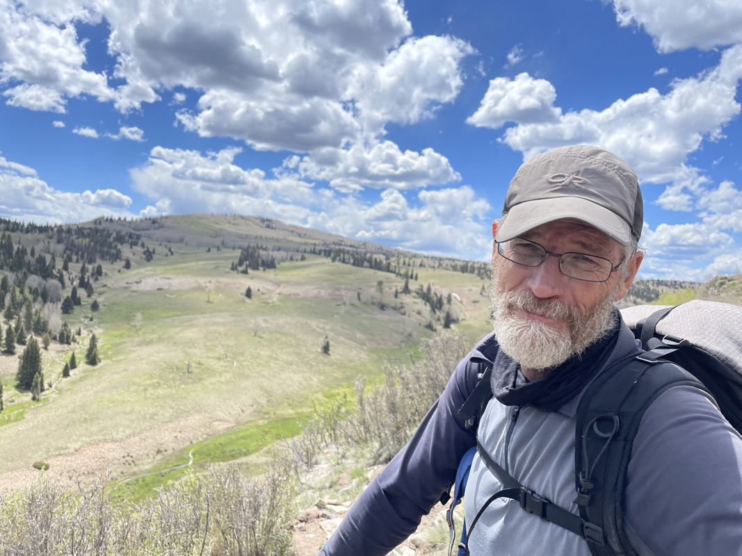
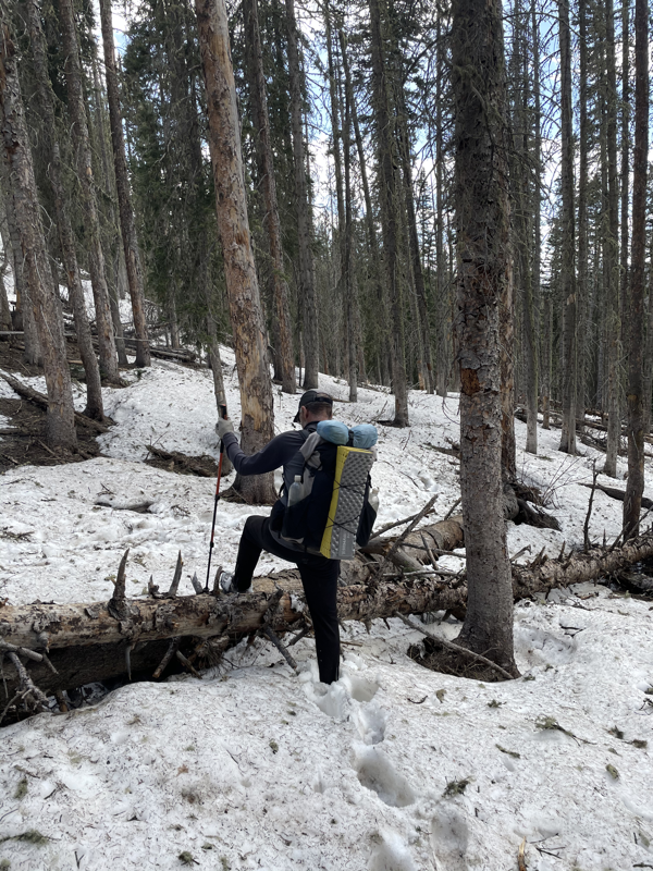
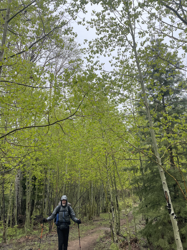
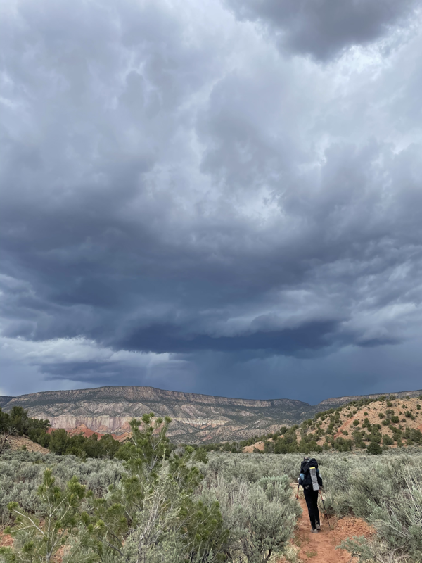
Well, we made it to Rawlins, Wyoming. A forest fire behind us (Morgan Creek) and forest fires ahead of us in Idaho and Montana. For some reason Wyoming has been spared at the moment but is a bit smoky, making for some magnificent sunrises and sunsets. I really enjoyed the hiking the past eight days. Even the 36 miles of paved roadwalk. We saw a moose, a bunch of elk, and some antelope. Got in a dust/wind storm. Beautiful sunrises. We hike between 11-13 hours a day but we’re slow, so around 17-19 miles a day. The climbs are easier, and I’ll tell you a secret, steep climbs are really hard on me. A combination of trouble breathing (asthma) and not building muscle like I used to. One reason I’m looking forward to next week... Tomorrow morning we head into the Great Divide Basin, a relatively flat and hot section, about 120 miles. Little shade and long water hauls—but I’m looking forward to making good time. Hopefully 25 mile days. And we‘ll be carrying some great food: small cereal packets (think Cinnamon Crisp, Frosted Cheerios, etc.), jalapeño kettle chips, dehydrated chili with an avocado, peanut butter-filled pretzels, dill pickles... we’ve gotten sick of the same old, same old, so we’re forging new territory in meal planning. TYPICAL DAY ON TRAIL 4:00 am Wake up. Eat breakfast, drink coffee, break down camp. 5:00 Hike! 8:00 Snack break 10:30 Lunch break 12:30 Snack break 3:00 Snack break 4:30-6:30 Make camp, have tea and a sweet treat, eat dinner. 7:30 Watch something or read a book downloaded on my phone. 8:30 Sleep! YES! I know, exciting, right? In my next blog entry I’ll describe a typical day in town. I’m happy to say we’re still are enjoying ourselves and have the appetite to continue. Many have quit and gone home, due to fatigue, injury, or personal matters. Lucky to have each other and this opportunity. Onward to Landers, Wyoming. One of our favorite trail towns. While vacationing in Estes, the weather forecast predicted rain for days, including thunderstorms. Not wanting to walk the ridges in snow, rain, and lightening, we started out on the Great Divide Mountain Bike Route, only to be diverted to forest road 100 due to forest fire. We actually had to slow down in order to not arrive in Steamboat before the Fourth. Along the way, we saw a beautiful white horse in a distant valley. Surprised when she ran to greet us. Even more surprised when she walked along beside us for miles. And what an auspicious omen, as this was my first day of retirement, free from routine and the expectations of employment. “White horses are seen as a good omen—they represent purity, peace, and good fortune. Dreams of white horses can indicate happy connections with others, a healthy relationship with sex and ambitions, spiritual awareness, and being at peace and going with the flow of life.” Tomorrow we continue our hike on the red line to Encampment, Wyoming. We’ll reach the Great Basin in about a week, a flat and dry section, very different than the mountains of Colorado. We’ve spent the last nine days with friends and family. This respite gave us time to rest and energize, see people we love, and get organized for the next section of trail. The one common destination/factor for our three recent summer-long adventures (TransAm, Great Divide Mountain Bike Route, and the CDT), are our friends and trail angels April and Jeff, in Frisco, CO. They fed us, hosted us, and even threw in a full body massage on one trip. Many thanks to them both. ❤️ I flew back to Kansas on June 18 to celebrate my sister Cathy’s 60th birthday while John spent time in Frisco with his sister Barb. While in Lawrence, I got to spend some quality time with my sisters Karen and Cindy, plus see all my siblings and much of my extended family. Love = Positive Energy. Upon my return on June 21 to Frisco, I spent a glorious day with Barb and John, hanging out and cruising downtown. For our grand finale to our vacation, the ice cream on our pie, was a visit to Estes Park and Rocky Mountain National Park with my sister Cindy, nephews Ryan and Jeff, and niece Jen. Estes and RMNP have strong sentimental ties with our family and is my happy place. We hiked the Bear Lake trails, took a fly fishing lesson, soaked in the Sulphur Hot Springs, and ate some wonderful food. Good times. Backpacking tomorrow! We had planned to continue in the CDT but rainy weather is bringing more snow (irk) to the mountain tops so we are hiking the Great Divide Mountain Bike trail to Steamboat Springs. We WILL return to the CDT red line soon, I promise. Just not yet. Looking forward to celebrating the Fourth of July in Steamboat Springs! Three stories of emergency rescue this past week, all in the higher elevations of the San Juan mountains. In the first story, a woman was avoiding a certain notorious glissade (downhill slippery slide made of snow) by walking around it. Unfortunately a boulder came loose from the mountain side above her and crashed into her leg, breaking it. Bad news for her but somewhat good timing for the unconscious hiker that came hurtling down the glissade (I believe she called him “a human log”). This hiker had slipped, hit his head, and slid down the glissade. The woman with the broken leg had to wait for the helicopter to return after taking the unconscious dude to the hospital. (Both were later treated and released at the emergency room). The other emergency rescue wasn’t actually a rescue. In an effort to avoid what they considered dangerous snow conditions, a couple found themselves outside of their comfort zone and called for help. But instead of being helicoptered out, the emergency rescue team helped the hikers reach a safe spot and left them with some advice about backpacking in higher elevation snow conditions. Could be that all of these hikers have experience and knowledge for hiking in alpine snow. Accidents happen. John and I, on the other hand, are not experienced or educated about alpine mountaineering. So when faced with snow at higher elevations, we choose to hike lower elevation routes that involve lots of roadwalking. For us, the past eight days included a mix of hiking on the Colorado Trail and self-designed routes along local roads. I don’t mind roadwalking so much, John is NOT a fan. Sometimes we have differing opinions about which type of route to take. For example: the section of the Colorado Trail past Mount Princeton Hot Springs has two options. One option is to roadwalk a pretty flat 12 miles to Buena Vista. The other option is to follow the Colorado Trail for 30 miles with 6,000 feet elevation gain, then hike back down to the valley to avoid a snowy section. Two very different routes to reach pretty much the same place. Well, what to do? We hiked the longer route, mostly because John wanted to and I felt like a flake preferring to roadwalk. Yes, the route was longer and more difficult. But it was also prettier, with cooler temps and better photo opportunities, more solitude, and came with a feeling of accomplishment when finished. Some good news. The snow is almost all gone due to the high temperatures in Colorado during the last week. And since we are going off-trail for the next nine days to spend time with family, we will return to a snow-free Continental Divide Trail. We can safely return to the CDT red line, the main trail. The place of adventure, impressive photography, memorable moments, and exceptional stories. The first two days outside of South Fork, CO, consisted of low elevation, high mileage days (22-24 miles a day). We experienced rolling hills, streams, and good weather. As we reached the end of the mapped blue and green alternates, we made our way up to the red line. And this is where it gets interesting... Sunday, June 6. 11 miles. Ten and a half hours hiking. Woke up super excited! We would be reconnecting with the red line today after hiking alternates. Early this morning we hiked up Middle Creek Trail, 5.5 miles, with 1700 feet elevation gain. We reunited with the CDT red line at mile 1043 and celebrated with a view, Triscuit crackers, and Laughing Cow cheese. We made it back to the big league at 10,700 feet elevation. Perhaps we might even use these ice axes and micro spikes we’ve been lugging around. Reality rudely interrupted my alpine daydream when we passed through the Gate to Snow Hell at mile 1046.4, along the north side of the mountain range. The sky over the valley was dark, filled with storm clouds. Thunder could be heard in the distance. Deep snow drifts amongst the trees, as far as we could see. We wasted time and energy trying to hike around the snow. Finally determined we had to go through it. The only other footprints on the snow were a pair of snowshoes that never broke the surface. As it was the middle of the afternoon, the snow was wet and mushy with a likelihood of postholing with both feet, getting buried up to our bellybuttons or higher. So we did the logical thing. We crawled across the snow on our hands and knees. And sometimes we slid down the snow, glissading. Other times we scooted across the snow on our butts. We got super wet and cold. Definitely living in the moment with a keen concentration on getting through this. We climbed an additional 1400 feet on the red line, making it 3100 feet elevation gain for the day. After hiking a grand total of 4.5 miles in 5 hours on the red line, we bailed on the Silver Creek Trail, catching a snowmobile path down to the highway, where we walked to Poncha Springs. Feelings about the day: Alive. Engaged. Worried. Culpable. Proud. And at the end of the day, Relieved. We’re in South Fork, CO, celebrating my 58th birthday and resupplying. Our plans have changed a bit since we heard about more snow on the “red line”— the “official” CDT route. Currently we’re on the blue route but tomorrow we’re hitching a ride to Del Norte to hike the green route. Confused yet? Basically, we’re going even lower in altitude to skip snow. The last four days have been a blast. Lots of nice surprises along the trail—an inexpensive National Forest campground with running water, picnic tables, and toilet; sunny mornings; small towns with cafes and restaurants; beautiful Colorado scenery; and climbs to 11,600 feet with snow. My journal entry for this week is from Monday, May 31 Hiked for a little less than 8 hours, an easy road walk, a bit of uphill. Just as we’d hoped, we made it to the Gold Pan Cabins in Platoro, CO, just as it started to rain. We’re paying $30 each to stay in a large cabin, could have some roommates before the evening is over. We’re so grateful to be snuggly in a cabin while it’s thunderstorms outside. Even though the dining room is closed on Mondays, the owners (Michael and Debbie) cooked a chicken dinner for the CDT hikers. There was no electricity due to a transformer malfunction, luckily the kitchen had a gas stove. Dinner conversation was about the weather (will it rain/snow tomorrow?) and concern for the hikers on the red line. Michael told us that 40-50 bailed off the red line last week, seeking refuge from the snow. Postscript: A Great Divide cyclist joined us in our cabin. He got caught in the rain and was cold and soaked, Jeff from Denver. Great to talk bikes! Electricity resumed about 4am, just in time to bake biscuits, make coffee, and make an early start. Good times. Exciting moments from the week: At one point we needed to cross the Rio Vallecitos. Someone had laid a log over the water and decided to call it a bridge. I’d had enough of wading across water in the Gila River Valley — all those slippery rocks causing me to fall in the water. “Be brave,” I told myself. Halfway across my legs started shaking. There was no going back, only forwards. I tried to look straight ahead (not at the rushing water) but still needed to place my feet. In hindsight, not a smart choice but I made it across. John was smarter, he sat and scooched his way across the log. Yesterday we encountered the long-anticipated section of post holing and blowdown, beginning about six miles south of the New Mexico/Colorado border. Took us about six hours and was quite exhilarating at times. Twice my foot and shoe got stuck in deep holes and I had to dig out with my hands. At one point the trail got lost under thick blowdown and snow, forcing us to hike with our phones in our hands, using Guthook to lead us step by step. Memorable moments discussed with other hikers this morning at the Rio Chama Espresso shop. I believe the term is ‘bragging rights.’ And we crossed into Colorado this morning after hiking 555 miles in New Mexico! We’ve hiked 34 days, averaging 16.3 miles per day. Taken 11 zero days, mostly due to shin splints (better but not gone). One state down, five to go, approximately 2400 more miles. Deadline: September/October Montana snow. Hiker post-holes up to his neck!
Hiker loses shoe in post-hole and hikes out in his Crocs! Hikers glissade 100 feet down mountainside! Hiker retreats south to Chama after ski bindings break! All this snow excitement awaits when we return to the trail. Right now we are in a hotel room in Chama, waiting for John’s shin splints to calm down. (My gosh, if we can just be patient and run through the entire list of hiker injuries, we’ll be bullet-proof by mid-Colorado). John’s shin splits began hurting two days out of Cuba, after a particularly challenging day (see previous blog post). We left the trail two days later, hitching a ride north to Chama. Monday morning we’ll hitch a ride back to highway 84, hiking the 88 miles to return to Chama. There is a bottleneck of hikers in town. Some are waiting for snow to melt before they continue north; others are planning to flip north to Wyoming, flopping back to Colorado later in the year. And this is a below average snow year. So we’re having fun painting postcards for our granddaughter, watching Andy Griffith and The Office reruns. Taking hot baths and reading. Eating Reese’s Peanut Butter Puffs with cold milk. All the usual zero day stuff. Funny how our thruhike-endurance-challenge keeps getting interrupted by these mini-vacations. Will we reach Canada? Stay tuned. Leaving Cuba on Monday, we gained 3,244 feet in elevation, camping at 10,143 feet. A dramatic change from the canyons of New Mexico, we found ourselves surrounded by running streams, green grass, evergreens, and aspen groves. The water was so abundant, it ran through the meadows and over the trails. I really enjoyed the hiking and was feeling strong and upbeat. But throughout the day, the weight of carrying six days of food started to take a toll on our feet and shins. Our shoes got wet from the flooded trails turned into streams, plus we had some rather adventurous stream crossings. I would need to pass John my pack over the stream and strategize the safest way across. At one point the trail was covered in blown down trees and we had to scramble over a mess of trunks and limbs. But this was nothing compared to the next day... Notes from Tuesday, May 18. A PARTICULARLY CHALLENGING DAY. What can you say about a day that begins with frozen shoes and socks? It began snowing at 6:30am, continuing until noon when it turned to rain. We hiked through flooded meadows that soaked our shoes. It hailed before the day was done. We walked through peanut butter mud that added pounds to our feet and inches to our height, causing us to slip and slide up steep inclines. Hiked 19 miles in 13 hours. We hadn’t planned on such a long day but failed to get water when available, forcing us to hike longer than John’s shin splints could handle, causing re-injury. And saddest part of the day, I got angry late in the day. Cussed a lot. We argued for the first time on trail and that was heartbreaking. In hindsight, how did this day make me feel? I actually enjoyed the snow part, it was pretty and I’d rather hike in cold weather than hot. In cooler temperatures you don’t need to carry or drink as much water. I can live with wet feet as long as my core stays warm. The challenge came when I forgot to view this day as an adventure and a privilege. A choice to be hiking the CDT rather than living a comfortable and predictable indoor life. We’re having fun 95 percent of the time on the CDT. We’ve never considered quitting. But as every adventurer knows, fun times don’t make the best stories. So I’m grateful for May 18. A day that gave us many stories to tell and re-tell, growing ever more challenging and exceptional in our memories. |